Understanding Flood Risk Through AI and Survey Data Analysis - The Diverse Data Landscape Powering Flood Risk AI
The information fueling AI systems designed to understand and manage flood risk has grown dramatically in scope and complexity. This evolution is driven by ongoing technological advancements and the critical need for more effective tools. Today, the mix includes not just traditional measurements but also vast amounts of real-time data streams, increasingly originating from networks of interconnected sensors, alongside aerial and satellite imagery. Combining these varied inputs, sometimes referred to as multimodal or heterogeneous data, allows machine learning models to move beyond simple prediction towards dynamically assessing unfolding flood events and providing timely information or alerts. Yet, navigating this rich data environment presents significant challenges. Persistent issues like biases present in training data can compromise the accuracy and fairness of AI outputs, and ensuring that these complex models can clearly explain *how* they arrived at a particular risk assessment remains a crucial hurdle for building trust and facilitating practical application by those on the ground. The push for more resilient and adaptive flood management relies heavily on harnessing this expanding data landscape effectively, while continuously scrutinizing its limitations and potential pitfalls.
Examining the input feeding flood risk AI reveals a truly varied landscape, sometimes presenting unexpected sources and challenges.
High-resolution satellite and aerial imagery are becoming indispensable, with the level of detail pushing spatial resolution towards the sub-meter scale. This allows models to pick out fine-grained surface features and the presence of individual buildings, critical for understanding how water might actually flow and pool at a granular level.
Beyond direct observations, AI often trains on the massive output datasets generated by complex hydrological and hydraulic simulation models. When real-world flood data is scarce or non-existent for specific scenarios or locations, leveraging these validated (or perhaps, less validated) simulations provides crucial synthetic data to learn from, though biases from the simulation itself can be inherited.
Perhaps more surprisingly, exploring less conventional data streams like aggregated, anonymized mobile carrier data offers unique insights into human behavior during events. Understanding real-time population distribution and movement patterns can inform vulnerability assessments and potentially model evacuation dynamics, which is a crucial but often overlooked layer in risk analysis.
Moreover, granular, near real-time soil moisture data, whether from ground sensors or remote sensing platforms, offers a surprisingly potent signal for anticipating flash floods. By understanding how saturated the ground is, AI can gain several days' head start on warnings, though integrating disparate sensor networks seamlessly remains a practical hurdle.
Finally, the foundational digital elevation models (DEMs), while essential, aren't uniformly perfect. Their precision and accuracy can vary quite significantly within relatively small areas, influenced by factors like dense tree cover or complex urban structures. AI approaches are actively being developed to detect and potentially correct these subtle spatial artifacts, acknowledging that even fundamental data layers require critical evaluation.
Understanding Flood Risk Through AI and Survey Data Analysis - Bridging Quantitative Models and Survey Insights

Connecting intricate quantitative flood models with the lived experiences and understanding captured through surveys presents a significant, ongoing challenge. While advancements, particularly in AI, have dramatically increased our capacity to model flood behavior and predict impacts, translating these complex outputs into accessible information for local decision-makers or affected communities remains difficult. Too often, the detailed insights derived from technical simulations aren't effectively integrated with crucial qualitative data reflecting human vulnerability, preparedness, or perception gathered via surveys. Bridging this gap is vital because relying solely on expert interpretation leaves many stakeholders ill-equipped to understand their specific risks. Although emerging AI tools are beginning to offer potential avenues for synthesizing diverse information and communicating model outputs more clearly, the process requires careful consideration. Integrating technical model predictions with the nuanced context from surveys demands scrutiny, as both data types carry inherent biases and limitations that can influence the resulting risk picture and potentially lead to misinformed actions or a failure to build necessary trust.
It's insightful to consider the surprising ways in which seemingly subjective survey data intersects with and complements quantitative models when examining flood risk.
For instance, collecting anecdotal accounts and local knowledge through surveys, which are inherently qualitative, can serve as a critical quality check for complex physical flood inundation models. Surprisingly, these on-the-ground perspectives sometimes reveal inconsistencies or nuances in water flow and pooling that automated remote sensing or purely simulation-based analyses might miss entirely.
Furthermore, integrating insights derived from surveys regarding how communities perceive flood risk and their levels of preparedness adds a dimension to purely physical models that is frequently underestimated. It turns out that accounting for these human behavioral factors can, perhaps counter-intuitively, refine the predictive accuracy of quantitative flood risk models by incorporating real-world responses not captured by environmental data alone.
Researchers are also exploring non-obvious methods to convert subjective survey responses – such as individuals' trust in official warnings or their preferred channels for receiving critical information – into structured inputs suitable for quantitative risk communication models. This approach demonstrates promise for developing public alert systems that are not just technically capable but also genuinely effective in reaching and influencing behavior among the target audience.
Analyzing the disparities between modelled flood risks and the impacts communities actually report experiencing via surveys after an event can be quite revealing. This comparison is more than just identifying model error; it's a surprisingly effective mechanism for pinpointing specific critical infrastructure vulnerabilities or social factors at a highly localized scale that were not apparent from standard physical flood data layers.
Finally, gathering direct feedback through surveys on how end-users interact with and interpret AI-generated flood risk maps – essentially, assessing their usability and clarity – is proving surprisingly valuable. This isn't merely anecdotal feedback; it provides tangible, quantifiable metrics that can guide iterative improvements in how these complex AI outputs are presented, directly addressing the challenge of enhancing their explainability and, consequently, their trustworthiness for practical application in decision-making.
Understanding Flood Risk Through AI and Survey Data Analysis - AI Engines Translating Patterns into Probabilities
At their core, AI engines operate by discerning intricate patterns buried within complex data streams. Applied to flood risk analysis, this means sifting through everything from historical records and geographic information to current environmental measurements. The essence of their function lies in converting these recognized patterns – correlations, trends, spatial relationships – into probabilistic assessments of potential flood events or their impacts. Rather than offering single-point forecasts, these systems output likelihoods: the estimated chance of a specific area flooding, the probability distribution of possible water depths, or the assessed risk level under various dynamic conditions. This translation from raw information to quantifiable likelihoods is achieved through sophisticated computational processes, though understanding the inherent uncertainties and limitations within these probabilistic outputs is critical.
Here are a few intriguing aspects concerning how AI engines tackle the task of transforming observed patterns and data points into estimates of flood probability, from an engineering perspective:
Instead of simply assigning a single flood risk category or level, advanced AI approaches are increasingly focused on generating a full probabilistic *distribution* of potential flood characteristics (e.g., depth, extent, timing) for a given area. This isn't just predicting *if* it floods, but quantifying the likelihood across a range of possible outcomes, directly reflecting the inherent uncertainty in both the data and the underlying physical processes, which is a crucial engineering requirement for reliable risk assessment.
The AI doesn't just "recognize" a pattern like heavy rain on saturated soil; it statistically quantifies *how much* that specific combination of features increases the *probability* of different flood severities at a particular location and time. This involves assigning probabilistic weights and relationships across potentially vast numbers of input variables, essentially building a complex statistical model of influence.
Certain AI architectures can implicitly learn the probabilistic *spatial dependencies* between locations. They can infer, for instance, that a high likelihood of flooding upstream, given observed data, significantly increases the probability downstream, without needing an explicit, pre-programmed hydrological model connecting those points – they learn these connections directly from patterns in the data, which is both powerful and slightly opaque.
A critical, and often challenging, step is taking the raw probabilistic outputs generated by the AI's internal model and calibrating them so they accurately reflect real-world flood frequencies and magnitudes observed historically. The model might confidently predict a "90% chance," but validating whether events predicted with that confidence truly occur 90% of the time they are forecast requires careful post-processing and comparison against limited historical records, a non-trivial engineering challenge.
These engines operate within incredibly high-dimensional probabilistic spaces, simultaneously juggling the statistical relationships between myriad data sources – topography, soil types, rainfall intensity patterns, sensor readings, satellite spectral signatures, and potentially even learned socio-economic indicators – to arrive at a final probabilistic assessment for a specific point on the map at a future moment in time. Managing this complexity and ensuring robustness is a core concern.
Understanding Flood Risk Through AI and Survey Data Analysis - Navigating the Realities of Data Gaps and Model Uncertainty
Even with significant strides in collecting vast amounts of information and employing advanced AI, navigating the inherent data gaps and the fundamental uncertainties within the models built upon them remains a core challenge in understanding flood risk. Our predictive capabilities, while improving, are fundamentally constrained by missing pieces in the data landscape – areas without coverage, periods lacking records, or simply insufficient detail. Simultaneously, any model is an imperfect abstraction of reality, introducing its own layer of uncertainty in translating complex physical processes or historical patterns into future predictions. This combined uncertainty isn't just a theoretical footnote; it directly impacts the reliability of the resulting risk assessments. Overlooking these limitations can lead to flawed conclusions and, critically, misinformed decisions by those tasked with preparing for or responding to flood events. Acknowledging and actively working to quantify and communicate this uncertainty, rather than presenting predictions as absolute certainties, is essential for building trust and enabling robust risk management.
Unpicking the complex statistical patterns identified by AI in flood analysis invariably bumps up against fundamental challenges rooted in incomplete information and the inherent limitations of our models.
Even seemingly minor voids in flood-related datasets can profoundly skew the underlying statistical relationships an AI system learns, potentially leading to inaccurate probability estimates even in areas geographically distant from the data gaps.
Advanced AI architectures strive not just to make predictions but also to delineate sources of uncertainty, attempting to separate the intrinsic, unpredictable variability in environmental phenomena (aleatoric uncertainty) from the uncertainty arising purely from imperfections in our measurements or the structure of the model itself (epistemic uncertainty).
The ripple effect of uncertainty shouldn't be underestimated; a comparatively small inaccuracy introduced by one data layer, such as variations in terrain detail from a digital elevation model, can amplify non-linearly as it passes through the AI's processing layers, leading to a significantly wider confidence interval or uncertainty bound in the final flood risk output for a specific location.
Rather than resorting to simplistic methods like data imputation or discarding incomplete records, some cutting-edge AI techniques employ generative approaches to synthesize multiple statistically plausible versions of the missing data, offering a more robust way to explicitly quantify how those information gaps contribute to the overall uncertainty envelope of the prediction.
Researchers are actively pushing AI beyond simply outputting a likelihood figure (e.g., a 1 in 100 chance of flooding); the goal is increasingly to also provide a credible estimate of the uncertainty *associated with that probability figure itself*, offering a crucial meta-level assessment of confidence in the model's own risk characterization.
Understanding Flood Risk Through AI and Survey Data Analysis - Operationalizing Forecasts The Hurdle to Real World Impact
By June 2025, while flood forecast models powered by advanced AI have become more precise than ever, translating this technical capability into consistent, impactful real-world outcomes remains a significant obstacle. The difficulty now often lies less in the prediction itself and more in the practical steps required to bridge the gap between a high-confidence probabilistic estimate and decisive, timely action by those on the ground, a challenge amplified by issues of trust, communication, and integrating complex outputs into existing response structures.
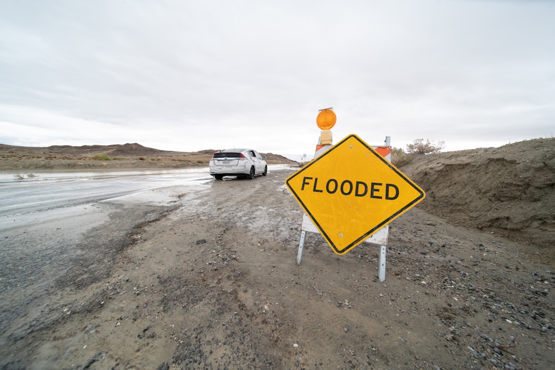
Getting flood forecasts from the lab or the modeling environment into actual use by people making critical decisions on the ground presents a set of entirely separate, often underestimated, challenges. It turns out that the hurdle isn't solely in building an accurate model; it's in getting that model's outputs to influence real-world actions effectively and reliably. This translational step, taking a probabilistic prediction and making it actionable within often constrained and rapidly evolving scenarios, is where things frequently become complicated.
Integrating the dynamic, complex outputs of advanced AI models into the often older, more rigid operational systems used by emergency management agencies or local infrastructure operators isn't a trivial task. These systems are built around established protocols and data formats, and simply piping a stream of high-resolution, probabilistic forecast data into them requires significant technical bridging and sometimes a complete overhaul of existing workflows. Beyond the pure engineering challenge, operationalization forces difficult choices about managing risk: balancing the economic and social costs of potentially unnecessary alarms (false positives based on forecast uncertainty) against the catastrophic impact of missing a true event (false negatives). This balance is acutely sensitive to how much trust is placed in an uncertain AI forecast, and the complex question of accountability when decisions informed by those forecasts lead to adverse outcomes adds a significant layer of operational hesitancy. Furthermore, the technical, often probabilistic language in which AI forecasts are expressed frequently doesn't align neatly with the clear, definitive, threshold-based decisions required by responders facing an immediate situation – a "70% chance of inundation exceeding 1 meter" needs robust, pre-defined protocols to translate directly into a "take action X now" directive. Even when AI provides highly accurate forecasts, they are often still subject to interpretation and potential override by human experts who bring invaluable local knowledge or contextual factors the model might not grasp, underscoring the persistent need for effective human-AI collaboration interfaces and decision-support frameworks in these high-stakes operational settings.
More Posts from surveyanalyzer.tech:
- →Daily Habits of Leading AI Data Science Freelancers Revealed
- →Analyzing Forerunner Safety Feature Data: New Dimensions for Survey Insights?
- →Logrx 0.4.0 and R Survey Data: Analyzing the Connection
- →AI Tools for Analyzing Consumer Deal Data: An Informed Perspective
- →Genetic Code Behind Cat Color Uncovered On X Chromosome
- →AI-Powered Legal Survey Analytics New Study Shows 44% Adoption Rate in Corporate Legal Departments by 2025